


Trips from Strážný
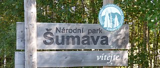
A series of excursion tips from the Šumava National Park
Near Strážný lies the narrowest part of the Šumava National Park. It is only 2 km wide, and most people simply pass through here on the main road towards Germany. However, Strážný is an excellent starting point for exploring the natural beauty of the Šumava National Park. If you park your car here and set out on one of the marked hiking trails, you will be pleasantly surprised – just beyond the last house begins the untouched nature and wonderful tranquility!
Strážný is situated in a broad valley of the Vltava and its tributaries. To the northwest, the terrain gradually rises to the Šumava highlands. The Knížecí Pláně (Prince’s Plains) can be easily reached by following the Častá stream. The abundance of water has created many wetlands and peat bogs, such as the Splavské peat bog encircled by the Řasnice stream, also called the “Grassy Vltava”, known for its carpets of underwater plants (visible at Dolní Cazov). This diverse landscape benefits both nature and its wildlife, as well as today’s visitors.
Trip Tips
Kunžvart Castle
There are not many medieval monuments in Šumava, as historically, the border forests served as natural defense against invaders. Kunžvart Castle was built to protect the Golden Path, along which salt from Salzburg was brought into Bohemia. We head to the castle ruins via the Chapel of the Virgin Mary. Although the guard tower has been decaying since the 16th century, the building material – stone – has given the castle a kind of “eternal” existence. From the rocky ruins, we continue to Orlovka, where a stunning viewpoint dedicated to Václav Hrubý, the legendary protector of Šumava’s nature, awaits us. The former village of Polka is also worth a visit. The return can be made via a loop or the shortest way back along the ski slope to Strážný.
Via Světlé Hory to Knížecí Pláně
A remote and lesser-known part of Šumava stretches along the Bavarian border, where scattered cottages of Horní and Dolní Světlé Hory once stood. The red-marked trail (TZT) will lead us there. Fragrant mountain meadows and perfectly laid stone terraces between the former fields are characteristic of this region. The past settlement is illustrated by historic photo panels displayed along the trail. On foot, we can take a detour to the Homole peak, where two massive menhirs stand on a rock, called the “pagan stones”. With enough time and energy, we can continue to Knížecí Pláně, or cycle there via the Žďárský pond. The way back follows the green-marked trail (TZT).
Soumarské Peat Bog
The restored peat bog near Soumarský Most is presented by a little forest gnome named Rašeliníček. The educational trail runs over wooden boardwalks or directly across the peat depending on the ground’s firmness. At the end of the trail, you can enjoy a view of the entire peat bog from a 10 m high observation tower. On the way back along the Vltava, you’ll pass several pre-war bunkers known as “řopíky.” Along the route, the resilience of nature will impress every visitor – few would guess that until 1998, peat was industrially harvested here.